Category: "Cloud science"
Bentley’s Most Singular Observation
March 2nd, 2022[This is the seventh and last in the series of re-posted articles, from 2012.]
You don’t have to look at frosted surfaces for very long before coming across something like the following.
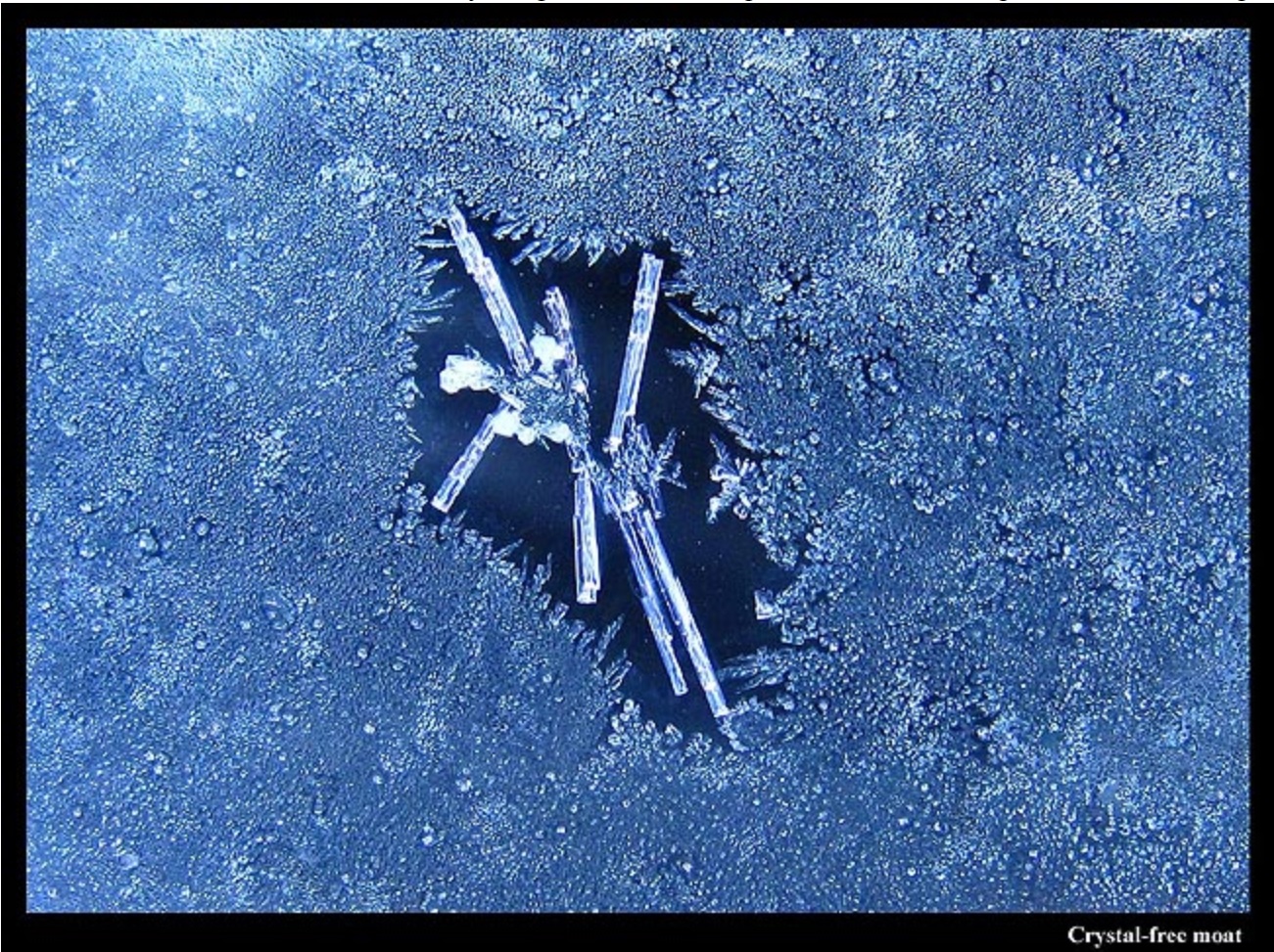
The picture shows a large ice crystal amid a roughly uniform sea of tiny frozen droplets. Between the large crystal and the frozen droplets lies a clear ice-free zone, a dry moat around an island of ice. Sometime prior to 1907, the Vermont farmer Wilson A. Bentley took notice of this moat. Writing in the Monthly Weather Review in 1907, he wrote
"One of the most singular, and doubtless most important, phenomena that occur in connection with the formation of window frost is this: The true crystalline varieties of window frost ordinarily, apparently, repel the minute liquid particles or droplets of water that frequently collect like tiny dew-drops on the glass, and freeze in granular form thereon."
Snow Crystal Variety and the Bentley Length Scale in Clouds
February 22nd, 2022[This is the fourth of the re-posted articles, from 2009.]
“… by means of these wonderfully delicate and exquisite figures, much may be learned of the history of each crystal and the changes through which it has passed in its journey through cloudland.”
W. A. Bentley, 1898
“… the crystals will in all probability be greatly modified by passing through atmospheric strata varying so greatly in density, temperature, humidity, etc. That they are greatly modified by these flights in the cloud is clearly shown by the interior structure of many of the crystals. ”
W. A. Bentley, 1901
Long ago, Wilson Bentley argued that the various layers (‘strata’) of air that a snow crystal falls through largely determine the appearance of the crystal. The first direct support of this claim came about 30 years later, from laboratory experiments by Ukichiro Nakaya, a Japanese physicist. Now, 100 years later, probably all cloud scientists would agree with Bentley. So, with all the crystal and cloud research that has been done since Bentley and Nakaya, can we determine the history of a crystal if we see its form? Can we finally do what Bentley said we should be able to do?
Hole in Cloud
February 20th, 2022A region of thin, high cloud becomes ice, making a hole. That is what happened in the picture below.
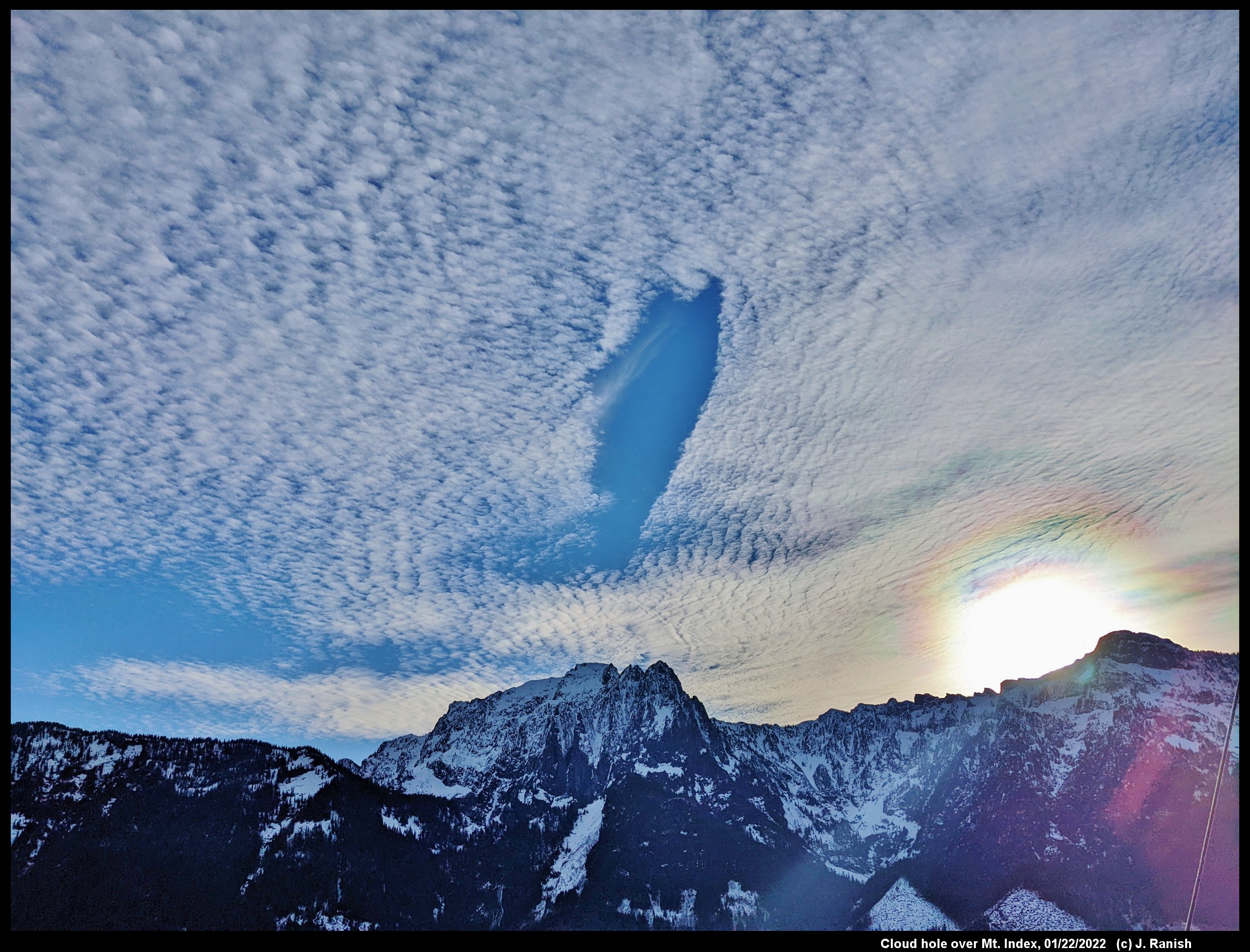
See the blue hole over the mountain? It may not be circular, but it clearly is a gap where once had been cloud.
If you look at that cloud, you might not realize that it consists nearly entirely of droplets. How do I know that?
The (colored) corona around the sun at the bottom right is a diffraction effect that occurs in thin regions containing nearly uniform-sized droplets. The angular position of the colored rings is solely dependent on the ratio of wavelength to droplet size. So, by noting the color and the position of the ring, one can deduce the droplet size in that region of cloud. Right now, we don't care so much about the droplet size as the mere fact that they must be droplets.
However, the droplets are almost certainly all well below the freezing temperature (perhaps below -20 C), so if a droplet happens to freeze, the resulting crystal will grow rapidly. Growing rapidly, it will both dry out the neighboring air, which causes the surrounding drops to evaporate, and the crystal falls. It falls below the cloud, into drier air, and then it too evaporates (actually, we use the term 'sublimate' for solids, but the process is the same).
If you look near the top of the blue hole, you can see a thin wisp of cloud. That wisp consists of falling ice.
So, that explains why there is a hole, but we have to wonder--why did it happen there?
Well, it must have gotten just a little too cold there, perhaps below -30 C. The cloud layer was probably rising as it moved from right-side to left-side (west-to-east), and a wave was produced where the air went over the mountain ridge that you see. The extra rise in that location brought the droplets into higher, and colder, air where they quickly froze. The wave is invisible, but its effect is not.
--JN
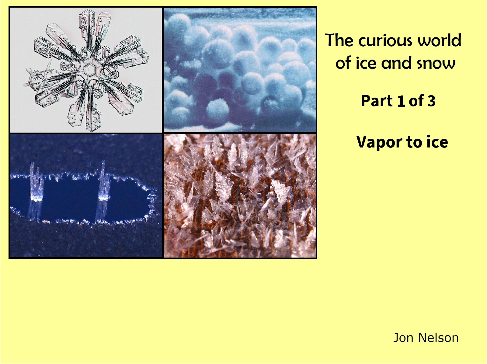
The Curious World of Ice and Snow: Part 1 of 3
February 4th, 2020In 2012, I gave a "science cafe" talk with a local series sponsored by the Pacific Science Center, KCTS public television, and Science on Tap. The title was "The curious world of ice and snow". The location was a bar in Kirkland, but open to all ages. When I showed up with my family, they tried to seat us in the backup room, the regular room having filled up, but I said "Oh, well I'm the speaker" and they kindly created a space for my family in the regular room. I was indeed surprised at the crowd. People are apparently more interested in ice than I thought. (Hmm, but where are they when I post here?)
Click on any image to see an enlargement.
The basic structure of each talk was to give a lecture of about 30 minutes and then allow up to an hour (I think) for the Q&A. In my excitement, I had created 41 slides, in retrospect too many for the allotted time.
Given all the time spent preparing the slides, I hope that by posting them here that even more folks can enjoy the images and discussions. But, instead of unloading all of them on you at once, I will break the discussion into three sections. By adding the following table of contents, each section will have 14 new slides and the total will be 42, which according to Douglas Adams* is a really special number.
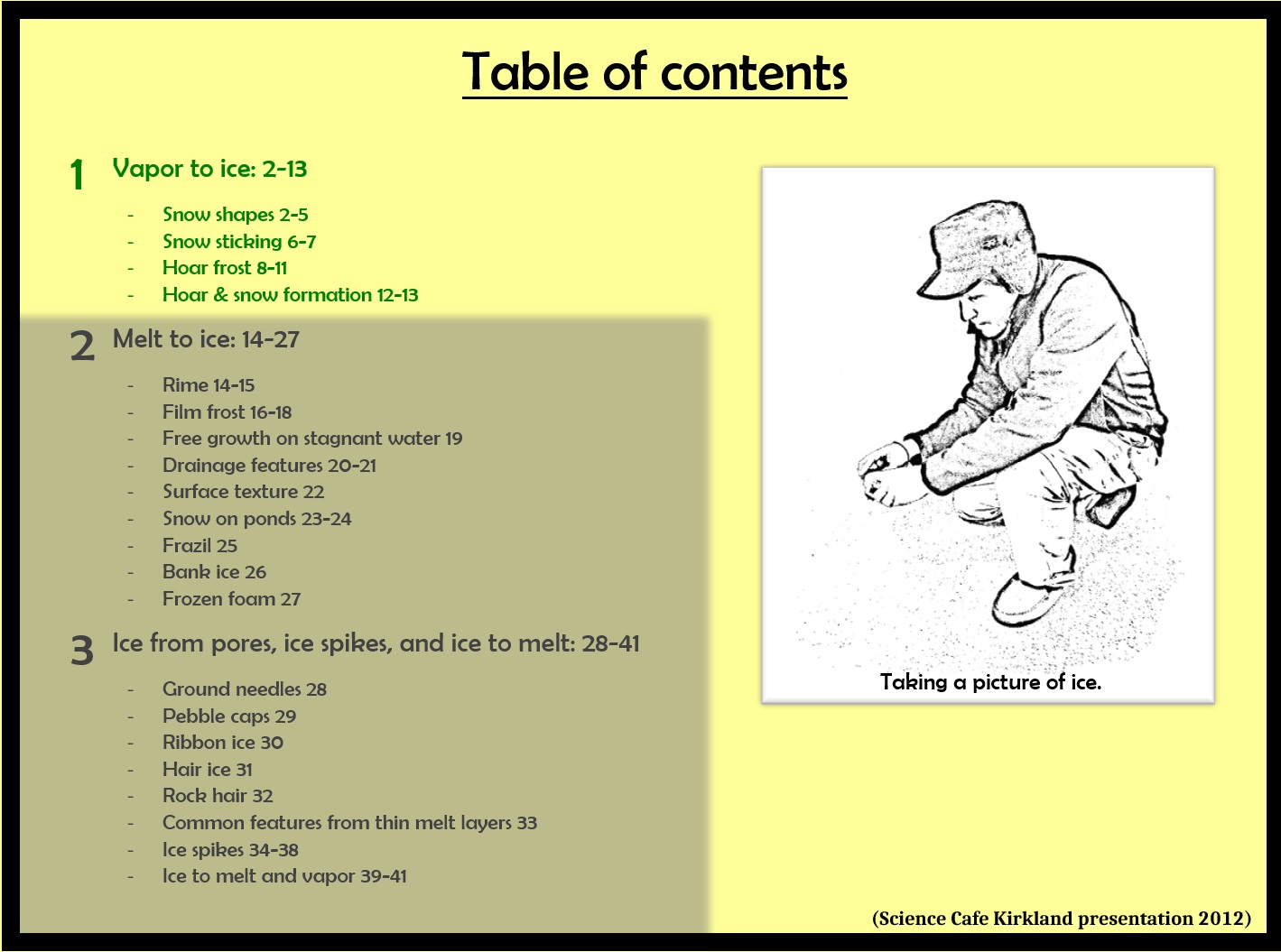
The contents of this section is part "1", written in green font.
A Fogbow
October 25th, 2017A fogbow, or cloudbow (fog is a type of cloud), is a special type of rainbow. It is just white, and so not as often photographed as the full-spectrum rainbow, but it can be exciting to see nevertheless.
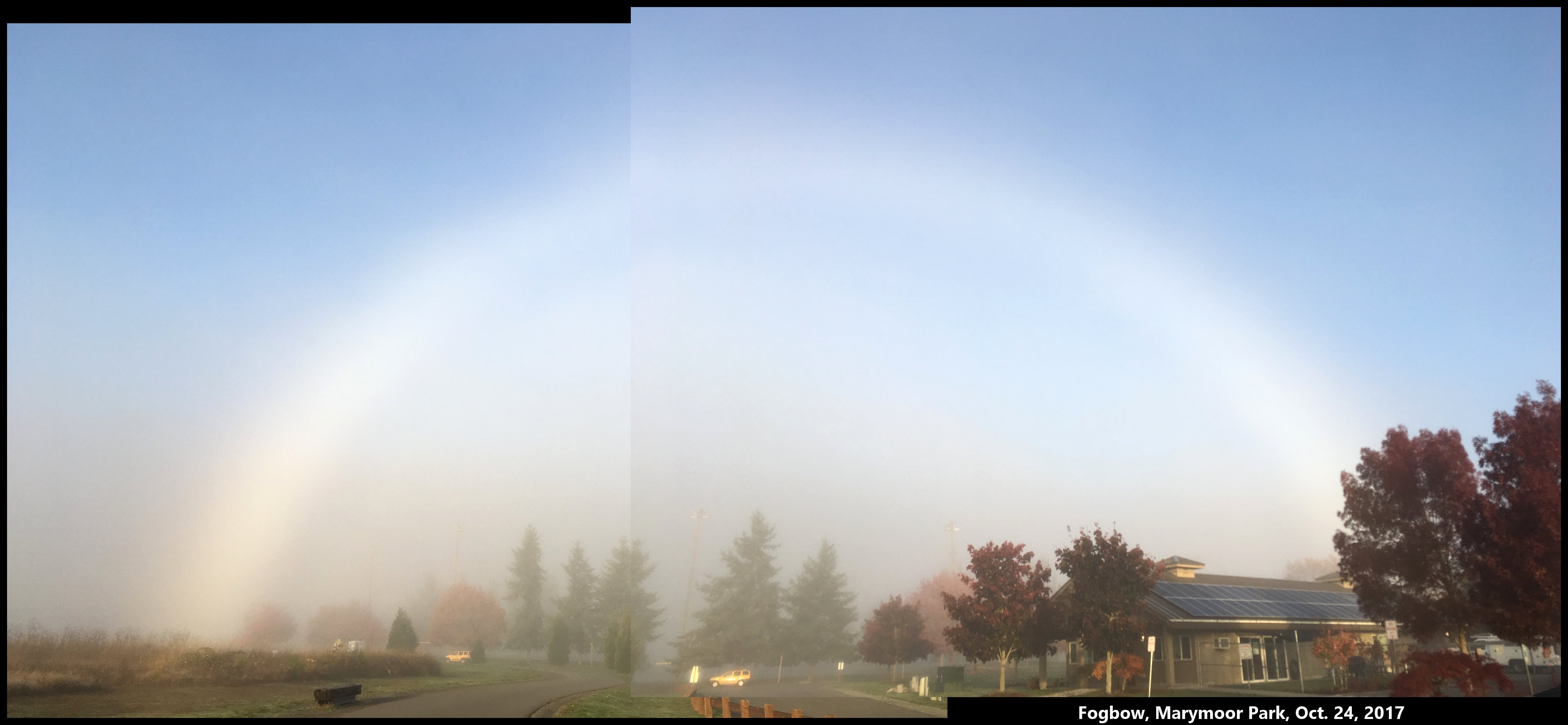
The reason the fogbow is white is because the water droplets in fog are much smaller than raindrops. Fog droplets may vary in diameter roughly between 1 and 20 millionths of a meter (i.e., 1-20 microns), whereas raindrops are typically 1-3 thousandths of a meter, or about 500 times larger. The wavelength of visible light is only about a half a micron, so the light rays inside a fog droplet are still fairly well defined, but there is simply not enough room to separate out the colors, to state things simply.
Upon approaching a fog in the morning, look towards, but above your shadow. About 50-60 degrees from the shadow of your head is where the fogbow will sit, just as it would for a rainbow. Evenings will work too. But midday, the angles 50-60 degrees above your shadow will have you looking at the ground, so you probably won't see a fogbow there. (If you are in an outdoor shower, you might see a rainbow though.)
The above photograph shows the fogbow I saw yesterday morning, about 8:30 am, biking into a nearby park.
-- JN
How clouds form snow
January 14th, 2017To understand snow formation, one must know a little about clouds.
Q: What is in a cloud?
A: Air, dust, vapor, droplets, and often, ice.
Q: How much air? How much liquid water? How much ice?
A: The answers will probably surprise you. See my short 20-min presentation below. I gave this recently to the Bellingham, WA Snow School. (23 slides, but due to file-upload-size restrictions, I had to put them into three parts below, 10 slides, 6 slides, 7 slides.)
Snow, rain, and weather affect everybody, yet how many of us learned in school even the most basic facts about precipitation in school?
Q: Who first realized how ice grew in a cloud?
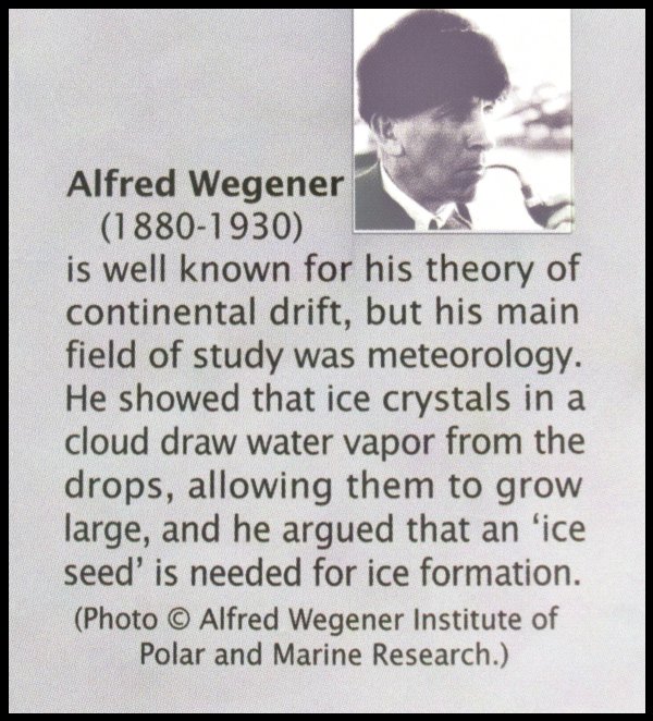
As described in my presentation, he realized this by observing frost on the ground.
Q: Who first realized how Alfred's theory was intimately connected with rainfall?
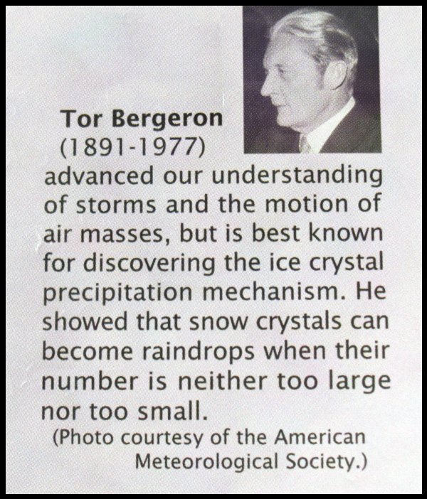
Tor discovered this by observing fog in a mountain forest, and like Alfred, applied some of his physics knowledge.
In my presentation, I discussed Alfred Wegener, the roles of the different cloud components, and briefly how the ice, once formed, takes on its strange shapes:
First 10 slides (with blue text added to account for the things I said during the talk):
http://www.storyofsnow.com/media/blogs/a/Jan2017/snowschool_annotated1t10.pdf?mtime=1484585328
Next 6 slides:
http://www.storyofsnow.com/media/blogs/a/Jan2017/snowschool_annotated11t16.pdf?mtime=1484585328
Last 7 slides:
http://www.storyofsnow.com/media/blogs/a/Jan2017/snowschool_annotated17t23.pdf?mtime=1484585309
Later, I will show specifically how the ice gets arranged into all these strange shapes.
- JN
Reflections off Falling Crystals
December 26th, 2009On my morning icespotting trip the other day (12/23), I caught a glimpse of an unusual sight - a sun pillar. I thought I saw one once last winter, but this one was unmistakable. It seemed more striking even than the one in Robert Greenler's book "Rainbows, Haloes, and Glories", a classic book on atmospheric displays. A line of light above the sun forms when sunlight reflects off the bottoms of falling crystals that fall a certain way - nearly horizontal. A pillar can form from either columnar crystals, oriented like a log floating on water, or tabular crystals, oriented like a frisbee in flight. For the reflection to reach our eyes, only the crystals that appear above the sun can reflect sunlight to our eye. So we see the reflections coming from the region directly above the sun, as in the picture. The same effect can occur below the sun, when the sunlight reflects of the tops of the crystals. I took this picture on the sunset setting of my camera, which boosts the reds, but the view to my eye was, if anything, more stunning.
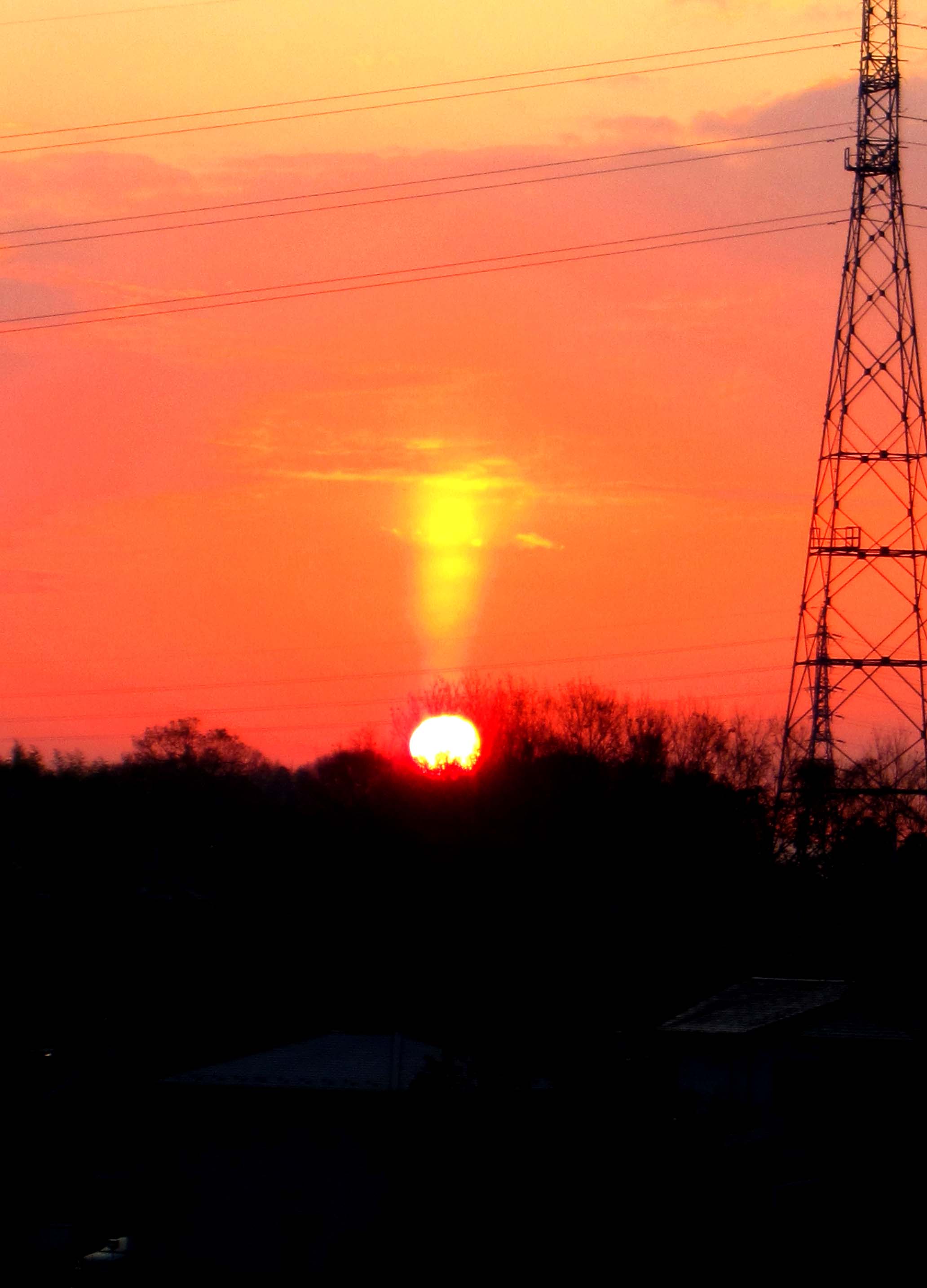
-JN
